How wide, roughly, is Tokyo?
Play today’s rounds
FreeNo account required5 rounds a day2 minutes
81% finish all five rounds
How to play
-
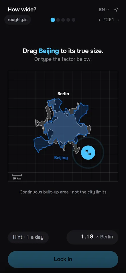 Two real cities on one grid. The grey one stands still, the blue one is yours to size.
-
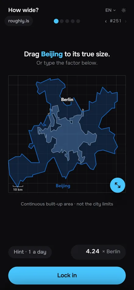 Pull the handle outward and the blue city grows, inward and it shrinks. Rather type? The field below takes the factor.
-
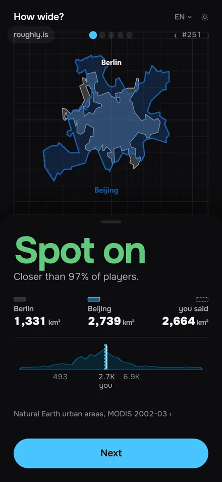 Lock it in. The blue city snaps to its true built-up area, and you see the factor you were off by.
The reveal
2.1× too small
Tokyo’s built-up surface runs on across the Kanto plain through Yokohama and Kawasaki, so the truth is 10,168 km²: five and a half Parises. Source ›
About 178 km across and 166 km deep. That box holds 29,548 km², and roughly a third of it is actually built up: 10,168 km². Yokohama, Kawasaki, Utsunomiya, Hachiōji and Maebashi sit inside the same unbroken surface, so this number covers them too.
What is in it
These, and more every week. Some stop where you expect them to, some keep going for another hour of driving.
- Tokyo
- Los Angeles
- Paris
- Cairo
- Sydney
- Geneva
- +and more
Questions
- Can I compare city sizes here?
- Yes, at the same scale. Each round puts one city next to another, and you pull it until it covers the ground it really does. The reveal shows the true built-up area, so you compare the cities themselves, not their borders.
- What is a Fermi estimation game?
- One where you reason your way to a number instead of recalling it. How wide? hands you two cities and a single handle; the reveal then shows the arithmetic that would have got you there.
- How do you play How wide?
- Pull the handle at the corner of the blue city until it covers as much ground as you think it does next to the grey one. One pull per round, five rounds a day, about two minutes.
- How is a round scored?
- As a factor: 2.3× too small, 1.4× too big. Come within five percent and it counts as spot on. No points, no ranking, no streak nagging.
- Is it free?
- Yes, and you never need an account. Past days live in an archive; your first archive day is free.
- Where do the city sizes come from?
- From the Global Human Settlement Layer (GHSL) of the European Commission’s Joint Research Centre: satellite measurements of built-up surface for 2020 on a 100 m grid (© European Union, CC BY 4.0; outlines and areas derived by roughly). One rule holds for every city: the continuous built-up area, not the administrative boundary. A river or strait up to 2 km wide does not split a city, and the water itself does not count. All sources are on the credits page.